
Part 1 : New Orleans
Part 2 : Texas
Part 3 : The Wild West
Part 3 : The Wild West

The Texas border, May 2012
Having left San Antonio in the morning, we drove all day and reached the border to New Mexico. There was a welcome sign for New Mexico. That meant there had to be a sign in the opposite direction with a welcome sign for Texas! One of our humans was not too happy with the photo that was taken of us at the border between Louisiana and Texas. He said, the sun was shinning from the wrong angle! Therefore he wanted a photo taken at the border between Texas and New Mexico because the sun was shinning on this sign! Okay then, so once again we entered the backpack, got out and took positions and... voila! A great photo. As you can see; we weren't the only ones to have a photo taken with the border sign in the background!
Click each photo to enlarge
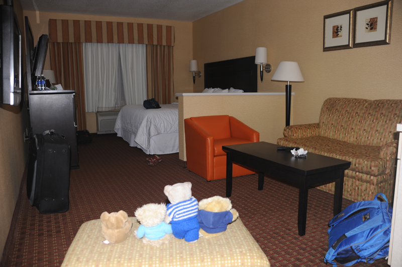
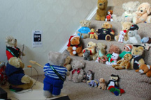
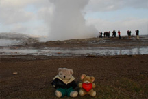
We arrived the Comfort Inn in Roswell late at night. Here, we had a lovely huge room and we shared a double bed - that is we had one side of the bed and our humans had the other side!

Roswell, New Mexico, May 2012
The next morning we went downtown. Roswell became famous in
1947 when a UFO supposedly crashed in the desert west of the town
causing a major fuss. Since then, Roswell has always been associated
with UFOs. McBear was hoping to see a UFO. Tom had an idea.
"I once read in Calvin and Hobbs that Calvin had taken the lights from
the christmas tree. He put the lights on top of the roof and shaped
the words "UFOs land here!" It was visible for miles at night. Maybe
we could do the same."
"Excellent idea!" McBear said in recognition. "Now we just need a
christmas tree with lights..."

We didn't find any christmas trees. Instead, we went to see
the UFO museum. McBear felt very inspired after the visit.
"When we return to Ireland, I want to set up a radio station to
contact alien teddy bears in deep space!"

New Mexico, May 2012
From Roswell we headed north west along the 285. The landscape
was flat and dry and seemed endless. We saw dust devils several
places - but no tornados to McBear's regret. McBear had studieded
numerous tornados on YourTube.
"McBear, just out of curiousity: what would you do if we encounter a
tornado?" Roger asked.
"Well, I... eh... I presume I'd record the incident and upload the
footage to YouTube... eh..."

We reached Vaughn and refuelled. Apart from the petrol station,
Vaughn seemed like a ghost town with lots of empty houses and closed
down petrol stations.
"There wouldn't be much point in setting up TARV - Toy Animals'
Rights of Vaughn." McBear concluded. "There doesn't seem to be a
single bear left in Vaughn!"

Still heading north west, the landscape kept getting more dry and desertish. After Albuquerque and Gallup we reached the Navajo Nation. This was Indian territory! The Navajo Nation is a vast area covering more than 70,000 square kilometers. That is as much as the entire Republic of Ireland! Wow! Here, the Navajos vote on their own president and have their own police to enforce their own laws.

Four Corners, New Mexico, May 2012
Here we are at Four Corners. This is the only place in USA where four states are joined in a single point: New Mexico, Colorado, Utah and Arizona.

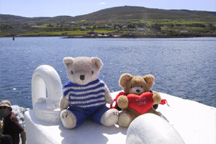
In the evening we reached Mexican Hat in the south east corner of Utah. We were tired and dusty after a long, long drive all the way through New Mexico. In Mexican Hat we stayed at the Hat Rock Inn. Last time we were in Mexican Hat was in 2002 on the way from New York to San Francisco. We were excited to be back.

Mexican Hat, Utah, June 2012
Next morning we got up early and enjoyed coffee at the San Juan River before heading off. It was a lovely cool morning and we knew another hot and dusty day was ahead of us.

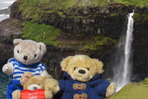
Having left Mexican Hat and the San Juan River we went uphill following the famous scenic route US Highway 163. Shortly after we could see the Monument Valley in the horizon. A trip back to this fabulous area had been on our wish list for years. Now, we could see the amazing skyline of rocks formations and we wished to explore it!

Monument Valley, Utah, June 2012
Here we are at the famous viewing point on Highway 163. This
landscape is printed on postcards and calenders everywhere and
it's hard to find a more breathtaking landscape.
"What about Icefield Parkway in Jasper National Park in Canada?"
Roger wanted to know. "I thought that was pretty cool too."
"And I've seen Machu Picchu in Peru!" McBear pointed out. "I
nearly lost my breath... well, actually, that had more to do with
the thin air at 12,000 feet..."
But we all agreed that only few places on Earth could equal the
Monument Valley.
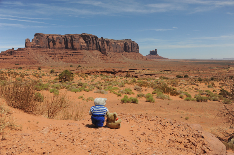
The northern part of the Monument Valley is located in Utah, however, most of it is located in Arizona. The buttes are made of hard silt sandstone. Once, hundreds of thousands of years ago the top of the buttes were at the same level as the surrounding soil, however, due to erosion over the years the soft soil had disappeared leaving the hard buttes as standing monuments. No wonder the Monument Valley makes such a great impact on the local Navajos and the tourists.

Monument Valley, Arizona, June 2012
The Monument Valley was the highlight of our entire adventure! But then it was time to say goodbye! We had a last glance at the fabulous rock formations before we started heading south.

On our way south we went through a small town called Many
Farms. A typical Indian place name. We stopped to refuel and buy
food and water. Phew! Dust really makes you thirsty! The people
running the store were obviously Navajos with their dark
skin and their own language. We went around the store searching for food.
"Why have we stopped at Cat litter?" Tom wanted to know.
"Cat litter?" Roger asked. "I had my eyes on the sweet corns on the
shelf above!"
"Cat litter?" McBear asked. "I had spotted salmon and honey on the top
shelf..."
We called the sales assistant to help us pick food from the shelves.

Indian Wells, Arizona, June 2012
We left Many Farms and headed further south. We passed a small
village called Steamboat and reached Indian Wells. We seemed to have
gone lost, however. McBear and Roger studied the map to make sure we
were on the right track. The Navajo Nation was full of colourful
rock formations and landscapes everywhere, but we were fairly busy
discussing where on Earth we were!
"This is why I have a GPS on my wish list!" McBear pointed out.

Having left the Navajo Nation, we reached Winslow and headed
west to the Meteor Crater. Many years ago McBear had come across
articles about a meteorite which hit the Earth about 50,000 years
ago. Since then McBear had always dreamt of seeing this incredible
crater in the middle of the Arizona desert.
The crater is huge! It is around 1200 meters in diameter and nearly
200 meters deep! It wasn't possible to have the entire crater on one
photo. Some of our friends, Aus and Rau, were here years ago.

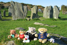
Petrified Forest, Arizona, June 2012
Next morning we got up early and headed east. On the way we entered the Petrified Forest National Park. Here we are at the south entrance.

The Petrified Forest covers a large area with a great number of fallen trees that grew during the triassic age 225 million years ago. Over the years the trees has petrified meaning they turn into stone. They all have broken into large chunks, but some of the trees are still lying on the ground like tree trunks.

Petrified Forest, Arizona, June 2012
It was a strange feeling to put our paws on what was once wood
but now had crystalized into stone. Some of the stones had great
colours like rainbows.
"It's a good thing we are not allowed to bring any stone with us."
Roger pointed out. "Too many stones have disappeared over the years."
"I am sure our owners appreciate the ban!" McBear said. "Imagine
their faces and reaction if we'd carry the stone we are standing on
to the car! And imagine how much we'd have to pay in excess weight
on the flight home!"
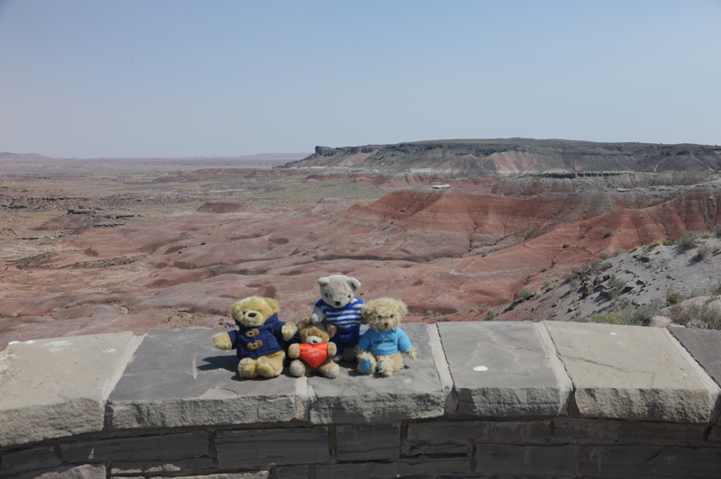
Just north of Petrified Forest is the Painted Desert. In fact, Painted Desert is an area which stretches all the way from Grand Canyon to Petrified Forest. That's nearly 200 km!

Edgewood, New Mexico, June 2012
On our way east we stopped for coffee in Edgewood. It seemed there weren't many Starbucks in New Mexico, but luckily we found a Starbucks at Smith's supermarket in Edgewood.
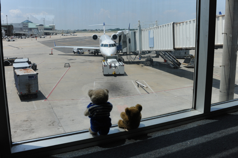
Having travelled through Texas from north to south east we finally reached New Orleans. Here, we stayed one last night at the Marriott Hotel. Next morning we packed our bags for the last time and went to the Louis Armstrong Airport in New Orleans. McBear said we were to fly with a CRJ900 to O'Hare in Chicago.

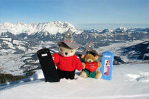
Somewhere over Canada, June 2012
From O'Hare we boarded an Aer Lingus Airbus 330 and started our long journey back to Ireland. Our flight coincided with the planet Venus transitting in front of the Sun in the evening. McBear was excited and wanted to watch it. Roger lifted McBear so he could see the transit. McBear had put on dark filters to protect his eyes.
Part 1 : New Orleans
Part 2 : Texas
Part 3 : The Wild West
Check out the map of Four Corners area


